We Farewell Türkiye – Datça and Cnidos/Knidos/Κνίδος/Kindos – or whatever you want to call it!

Hello, welcome, come aboard. We hope life has been kind to you in the last little while. It’s hard to believe that it’s the end of June! The year is half gone already. I was thinking about what we’ve done this month and had to chuckled. Didn’t I say something about “going slow”? It’s not been a full month since we last posted to the blog. In that time, we’ve left Türkiye, entered Greece, visited many anchorages/towns most of these on Greeks islands, travelling over 200 nm (370 km) including one 12-hour moonlit trip. That distance travelled doesn’t include the road trips we’ve also done to explore a few of the larger islands. We’ve even had our mate, Lesley visit with us for a few wonderful sun-drenched days. We’ve also been visited a couple of times by Meltemi winds (strong Northly winds) which have kept us in port or on the boat for days at a time.

This all seems crazily busy, and yet it still felt like a “go slow”. Some places we stayed for days, others we stopped in over night and kept on moving. I haven’t felt rushed except to say we were keen to move past the Meltemi zone (aka the Aegean Sea). Not just because of the Meltemi winds but because of the madness that is the summer charter boat season. There are about a dozen islands that we’ve not explored including some pretty famous ones, like Santorini and Mytilene. Thankfully, we will be returning early next year (outside the Meltemi and charter boat season) to explore these islands at our leisure. We figure this is advisable as, ironically, the winds make me cranky, and the levels of ineptitude and dangerous sailing we often see among the chartered boat crews is enough to make even my peaceable captain want to raise the skull and cross bones.

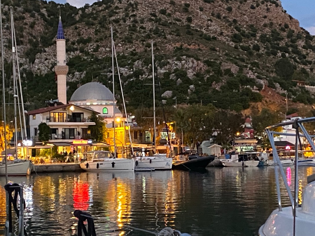
Selimiye – “the French Riveria” of Türkiye?

Anyway, when we left the last post, we were leaving Bozburun to stop off in Selimiye (both in Türkiye) as we were keen to share this pretty region with SV Chill. One very enthusiastic shopkeeper told Ali and I that Selimiye is known as the “French Riveria” of the Turkish Coast. However, we decided this was more a justification for the $600 price tag on the bag I had been eyeing off than any reality. Selimiye is a pretty, little village with a few lovely shops and bars along the shore and not much else. However, it’s worth visiting just for the amazing fjords-esque entrance to the bay. On our sail in this time, the weather was so lovely that Ian and I wove between the islands doing two knots (less than 4 km) under sail while we enjoyed our lunch. There are ruins on the islands and the sounds of goats in the distance.

Funny Thing! Above represents most of the photos I have of the lovely Selimiye. I’ve been here three times now. For me this is a novelty as I’m normally in a tither trying to choose among my hundreds of photos.
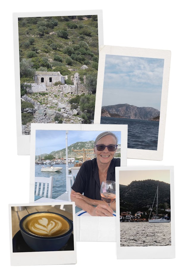
Special thanks to Ali for capturing this rare “proof of life” photo of me enjoying a Turkish Rosé  on the Turkish “French Riveria”.
Back during our first visit to Seliiye in 2022 we had our first flat white coffee since leaving Australia. While don’t remember if it was actually very good but if the last visit is anything to go by it probably tasted like dirty dish water strained through one of Ian’s grubby socks.

Trendy Datça

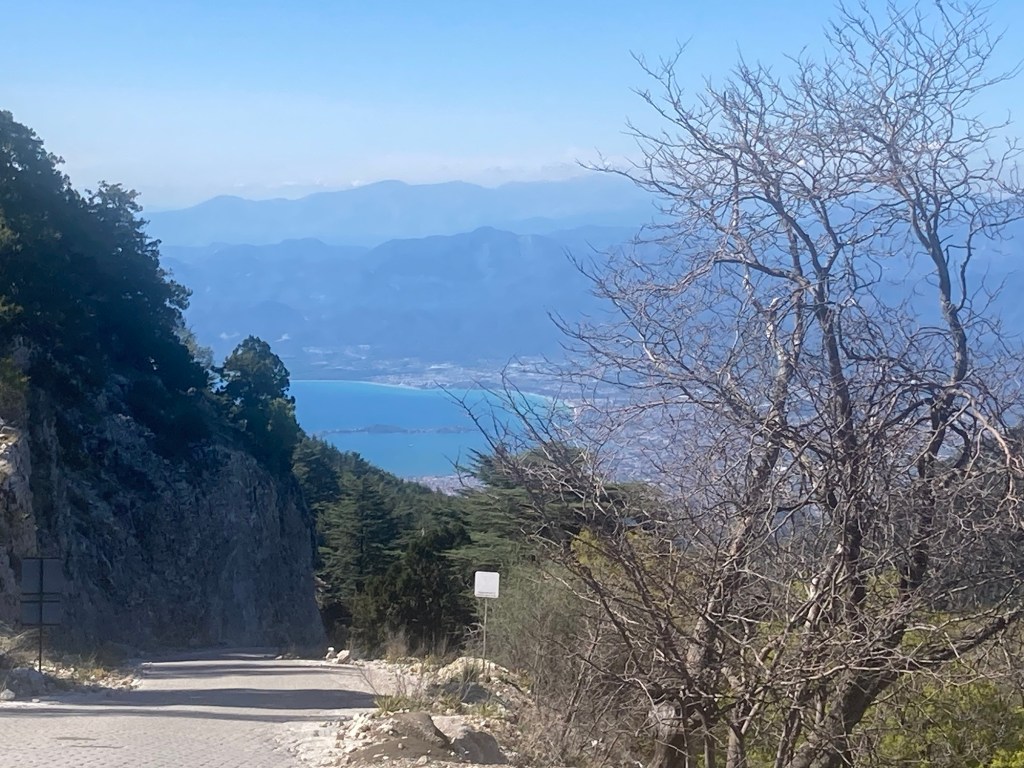
We didn’t stay long and after sourcing fuel and our dreaded blue card stamp from a neighbouring marina we sailed across the Bay of Doris to Datça, Türkiye. I love Datça, and while some might say I threw a mini tantrum when I thought we weren’t going to make it back there, I would prefer to say I was forthright during our planning session. While in Datça, a Meltemi blew in, so we ended up staying for well over a week with only an overnight trip out to Knidos to break up the visit.

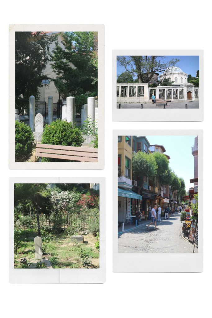
I at least was not heartbroken as we found time to check out Datça old town. It’s about an hour’s walk uphill in the heat. In other words, far enough to make us all hot and sticky and in need of an ice cream when we got there. Despite the heat it was a lovely day and there were plenty of folk out and about in the town.

Like many ‘old towns’ rather than being a slice of living antiquity, Datça’s old town unabashedly targets tourists. The noticeable difference was the absnece of tacky shops with in-your-face hawkers selling knock offs and tenyear spices. Instead there was a chic chill vibe with cafes and local artisan shops to explore.
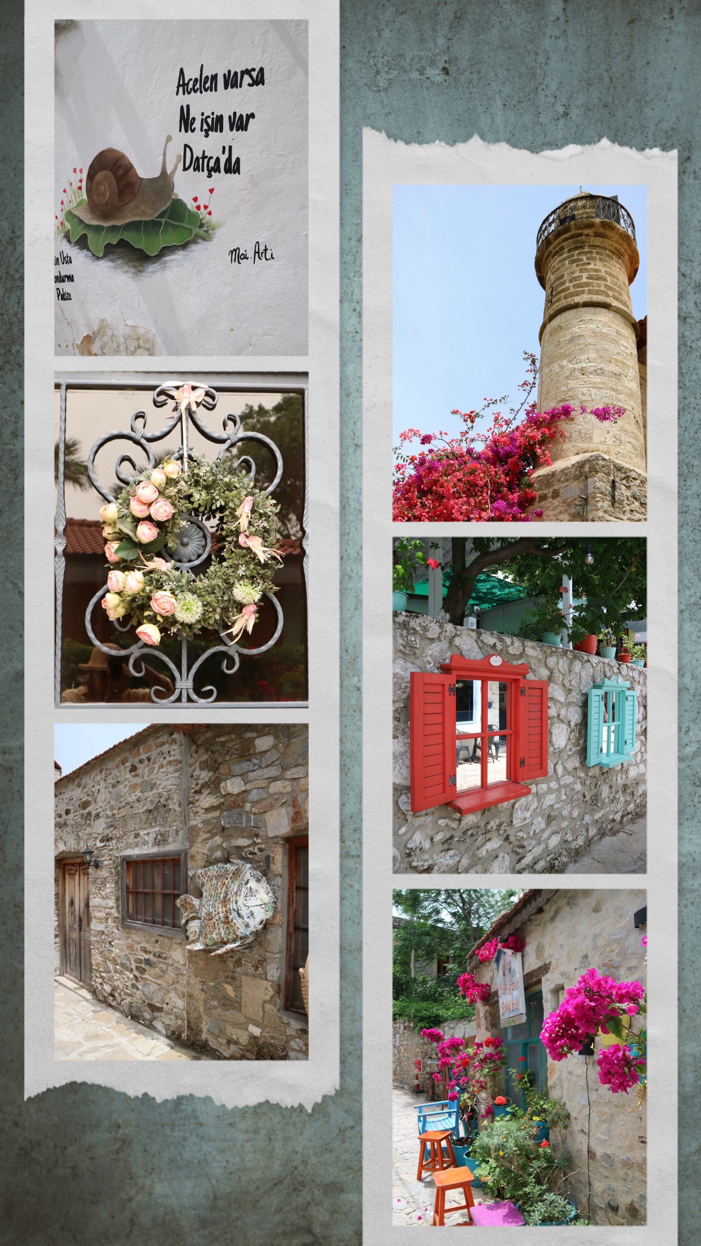
The street art says “If you are in a hurry what are you doing in Datça.”

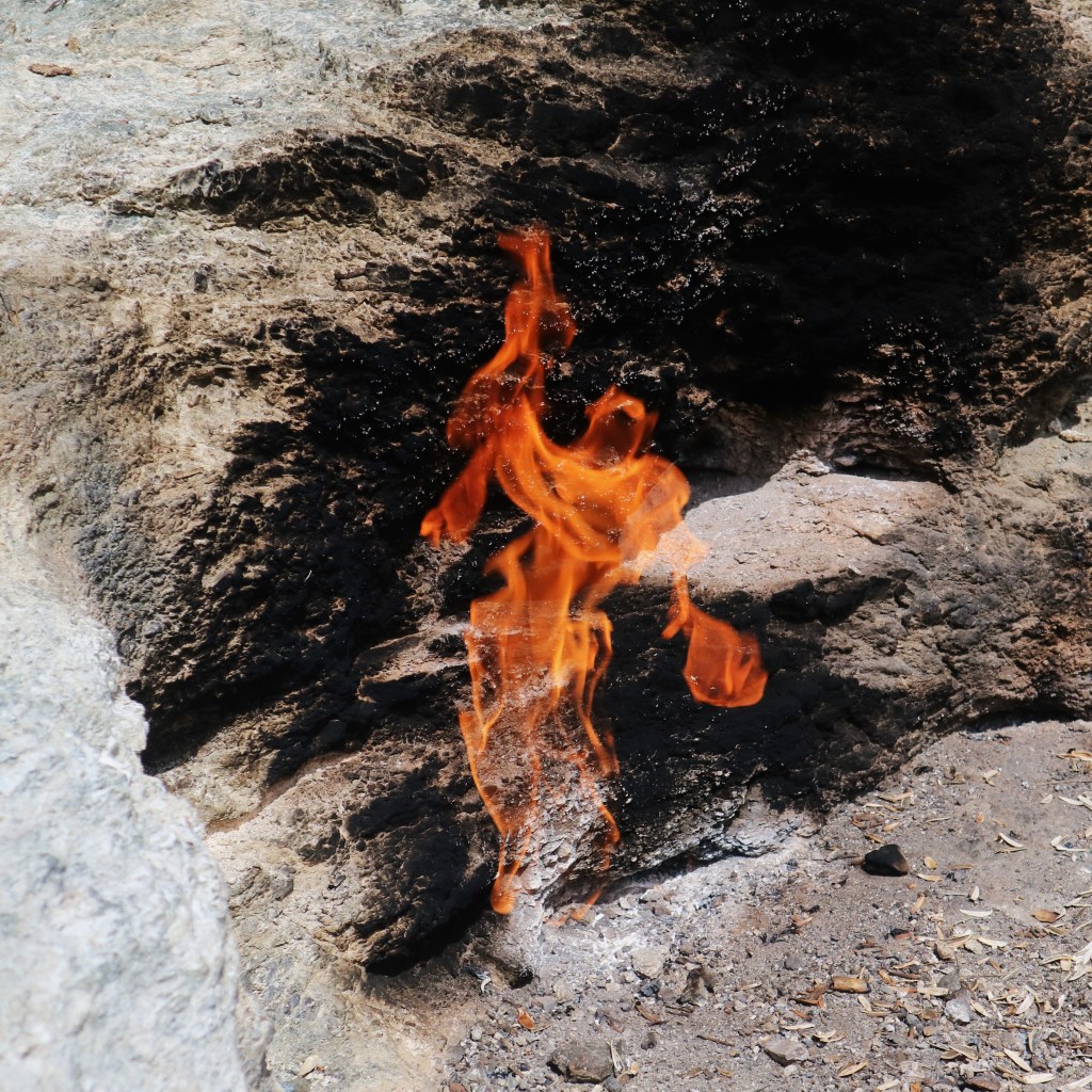
We had anchored next to the little port of Datça and near to there is a natural hot spring flows into the sea. At least it’s supposed to be a hot spring. While we were there it felt more like a tepid bath perhaps in Winter the vibe is different. These springs are open to the public (no fee) and it’s clear the locals use the amenities a fair bit. There’s a little stream between the spring and the bay where you can experience the indulgence of having your feet “cleaned” by schools of fish. While we restricted ourselves to just a pedicure some of the locals walked or floated along in the stream. I guess the last item of their to do list before leaving is to shake out their shorts. The fish aren’t small, like the ones you see in the shops that offer this back home. There were one or two that rivalled my size ten stompers. I guess they get fed well; Ian certainly provided a feast.

This gorgeous puppy belongs to the cafe. Not sure if her preferred sleeping position is a clever marketing ploy or not but it certainly had us staying for “just one more”.
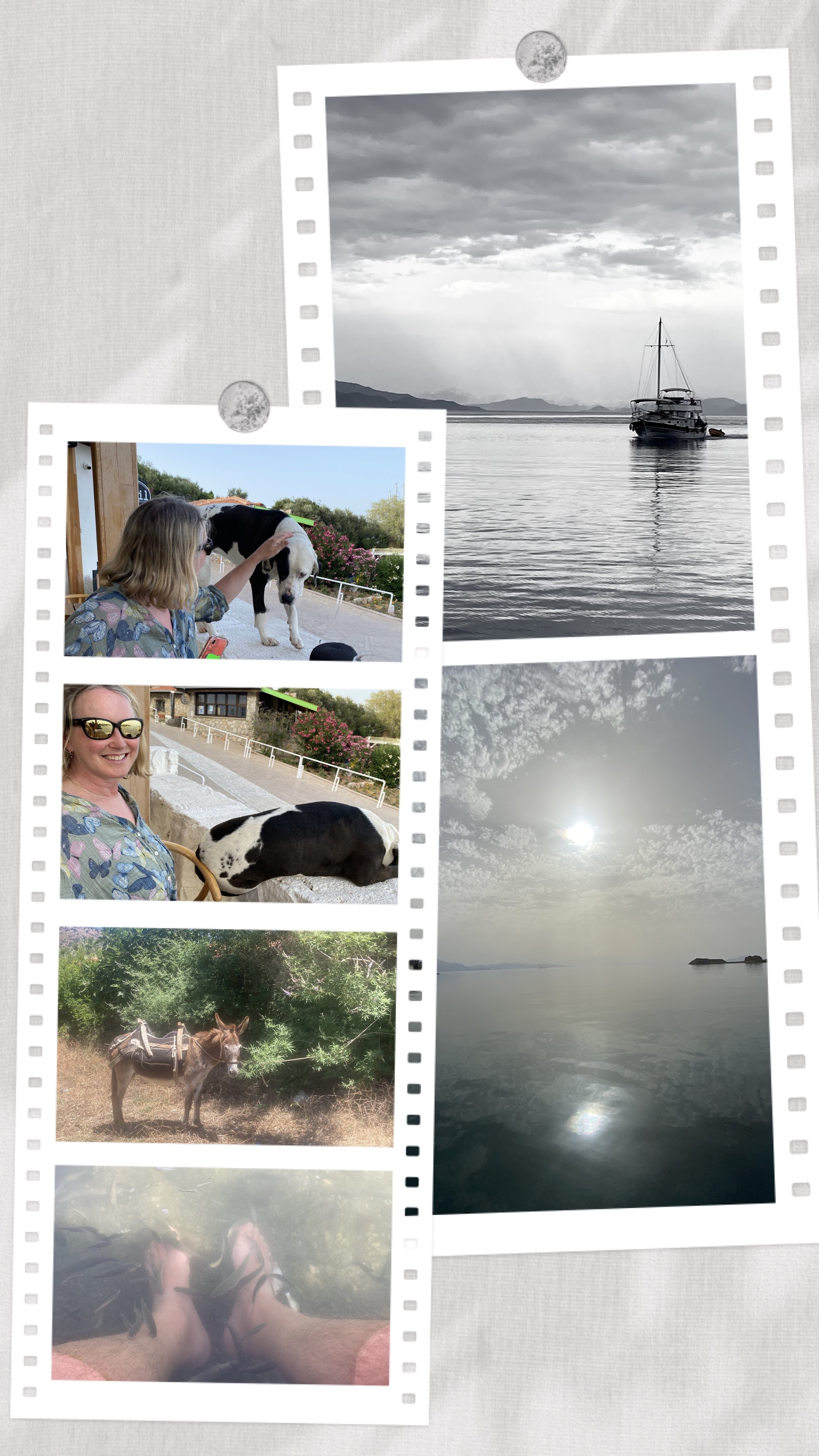
The donkey belongs to a goat herder we saw wondering along the shore of one of our anchorages.

The fish pedi is not for the ticklish.
Despite there being blustery winds much of the time we were in Datça, we had some moments of surreal calm especially in the early mornings and late evenings.

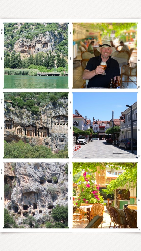
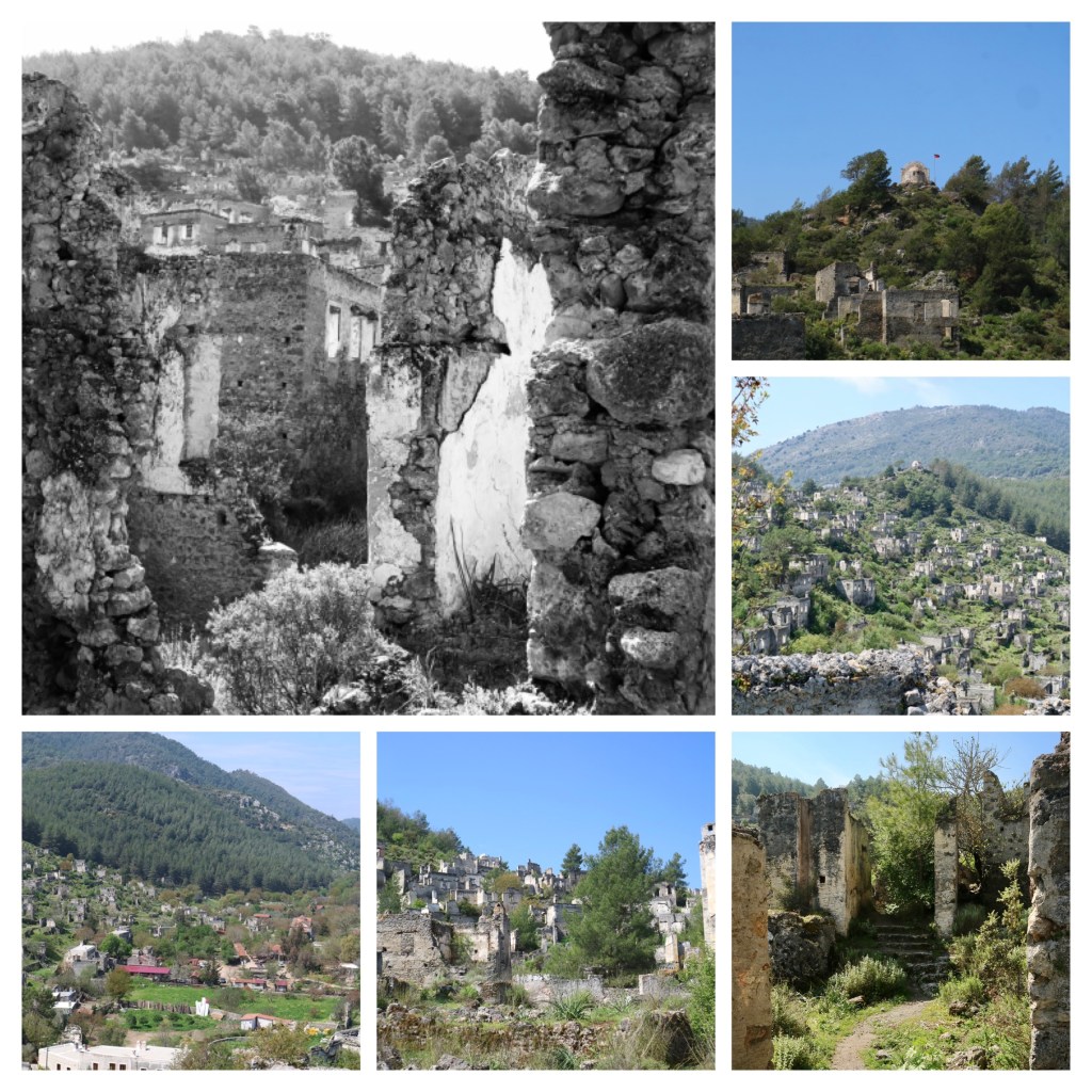
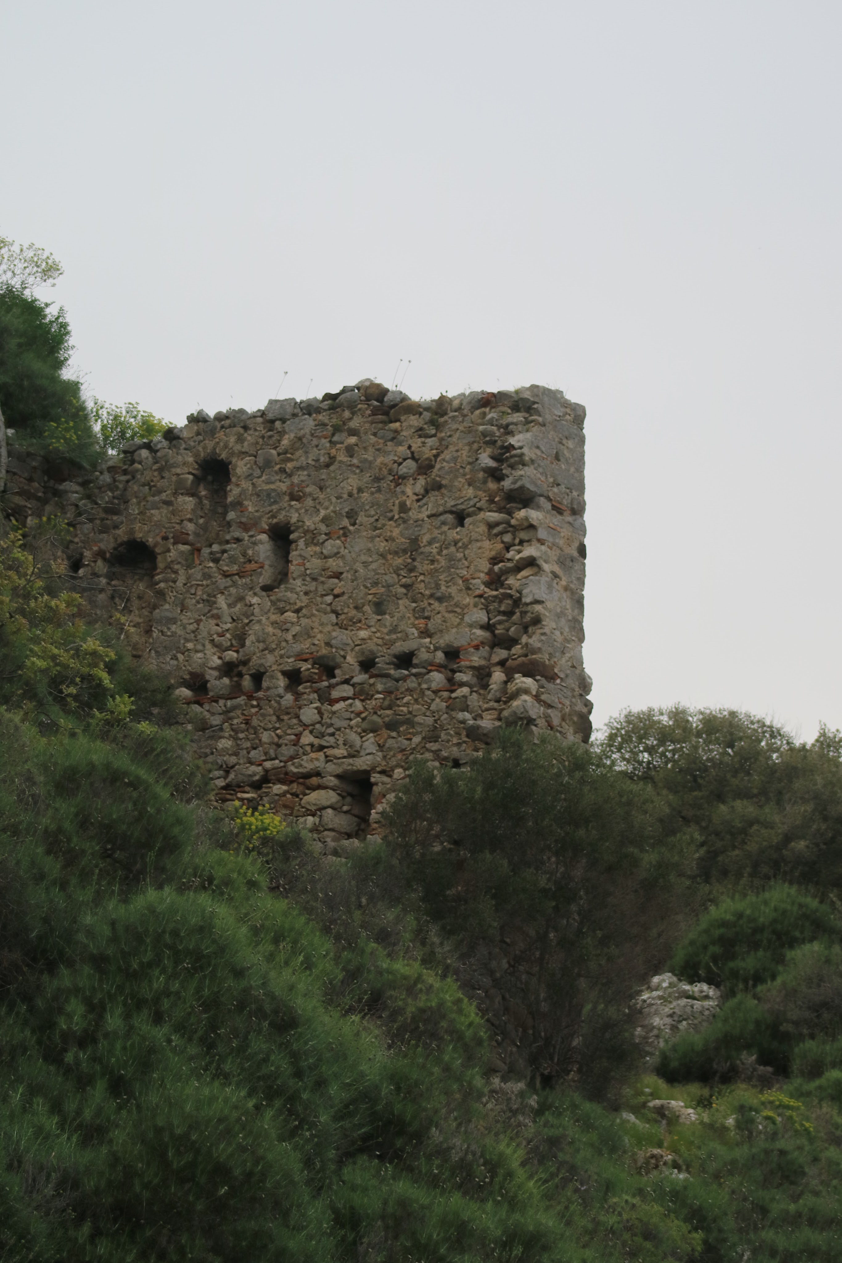
Knidos, Cnidos, Kindos, or whatever you want to call it

The Ruins

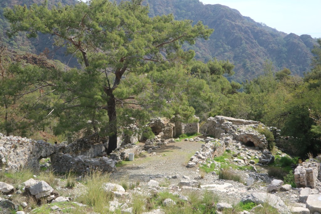
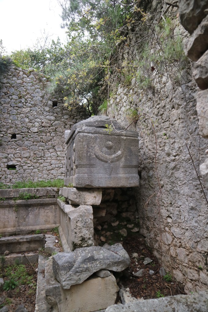
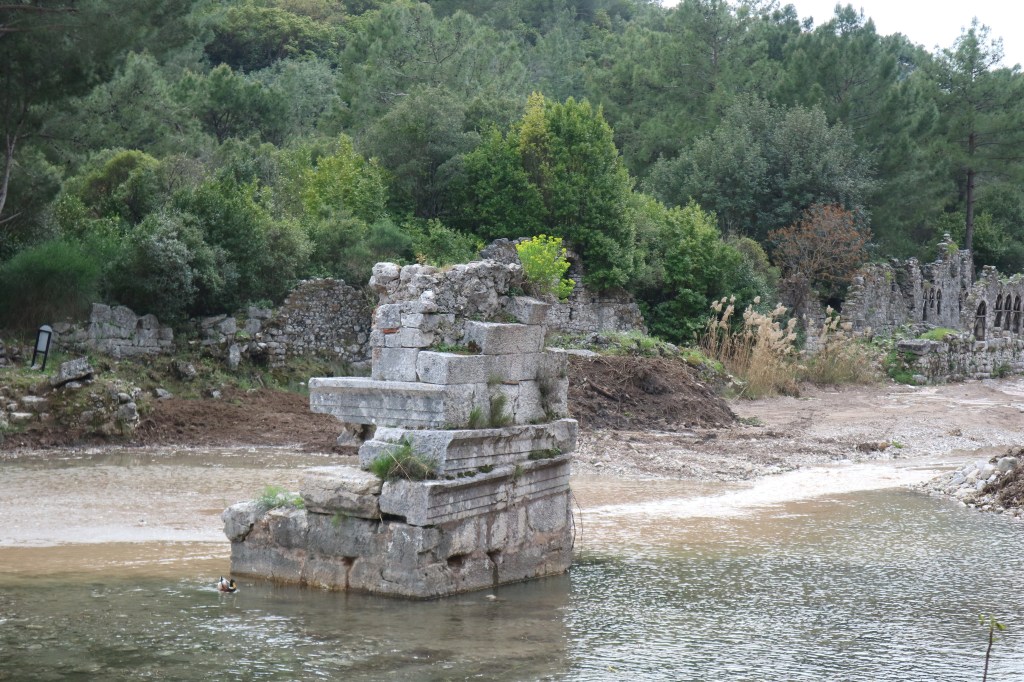
As I mentioned we took a day off from Datça and sailed down to the ancient city of Knidos /Cnidos/Kindos or whatever you want to call it. This must have been an impressive sea town once, with its two bays; one dedicated to the military and the other a commercial harbour. It’s mentioned in a number of historical texts as having strategic importance throughout Greek history, including the Decelean or Ionian war in which lasted almost a lifetime. The Spartan’s campaigned in and around Anatolia during this time, often using Knidos as a port of convenience. The Spartan’s played the Greeks (Athenians), the other local Leagues such as the Carians, and Persians off against each other. Reneging on their promises and changing allegiances to suit their own designs. In 394 BCE a major sea battle occurred near Knidos between the Achaemenid Empire (Persian Empire) and the Spartan Fleet which was based at Knidos during the Corinthian War. The Achaemenid’s fleet defeated the Spartans. I wonder if instead of the Spartan king giving the job of leading his fleet to a favoured relvative called Peisander, had the Spartans had hired a Scottish actor to lead the fleet if they would have had a better outcome?

1. TOn the left is the commercial harbour and on the right is the military or trireme harbour. We anchored in the commercial harbour since we weren’t there to go pillaging and plundering.
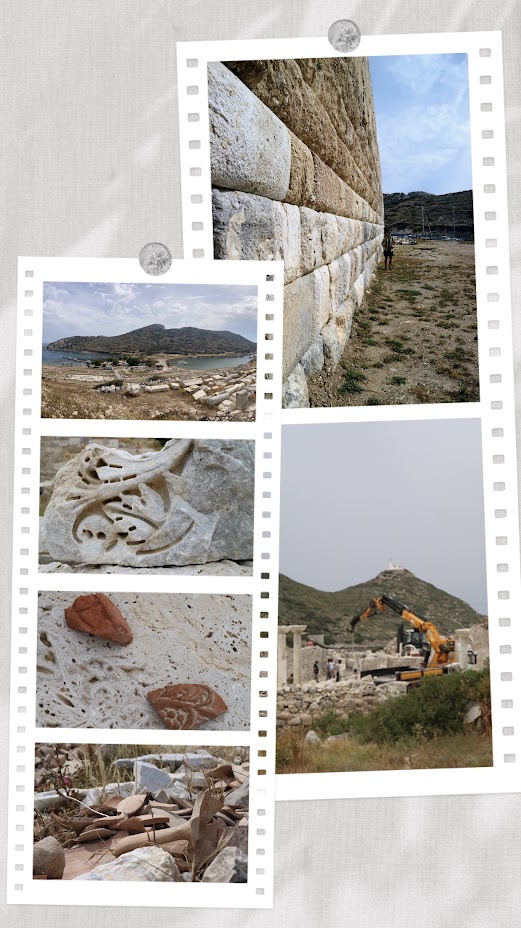
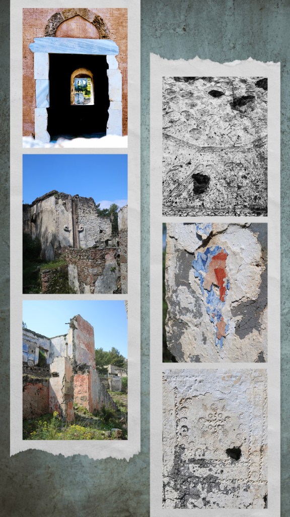
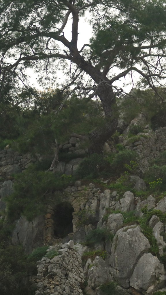
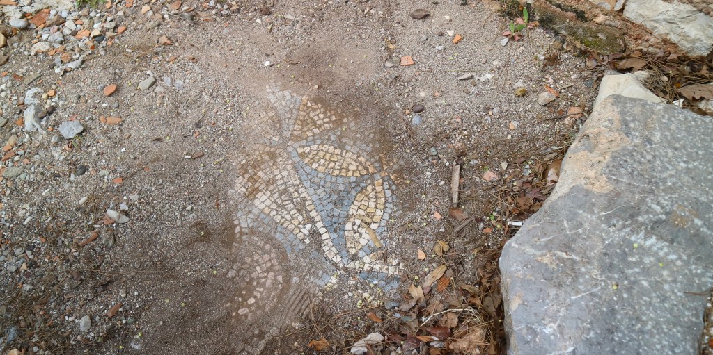
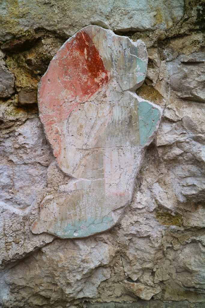
2, 3. & 4. In addition to all the temples, churches, and other buildings at many of the sites we’ve been to, there are often small artecfacts scattered about. Nowhere we’ve been has this so been as prolific as Knidos. One of the shards in the middle photo we found and returned to the front gate. The last photo is of one of the many midden heaps that can be found throughout this substantial archaelogical site.
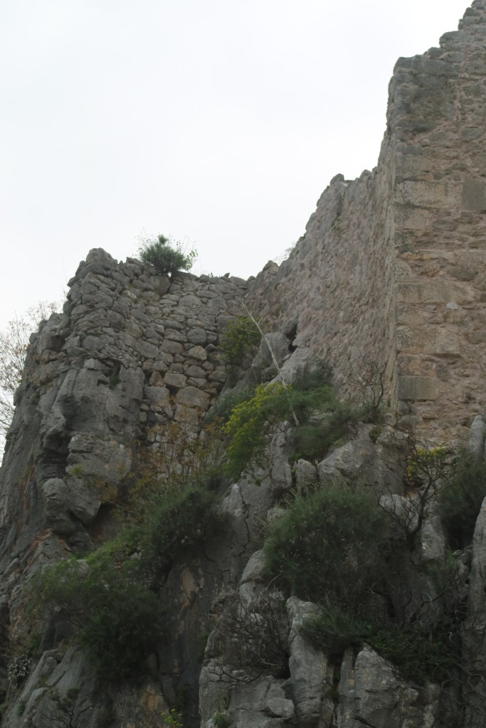
5 & 6. Ancient vs Modern workmanship. In the top photo you can just see Ian standing next to the wall, which surrounds the Knidos theatre. The wall was built in 2 BCE by master masons and slaves. The second photo is how the modern restoration team in rebuilding the temple next door.
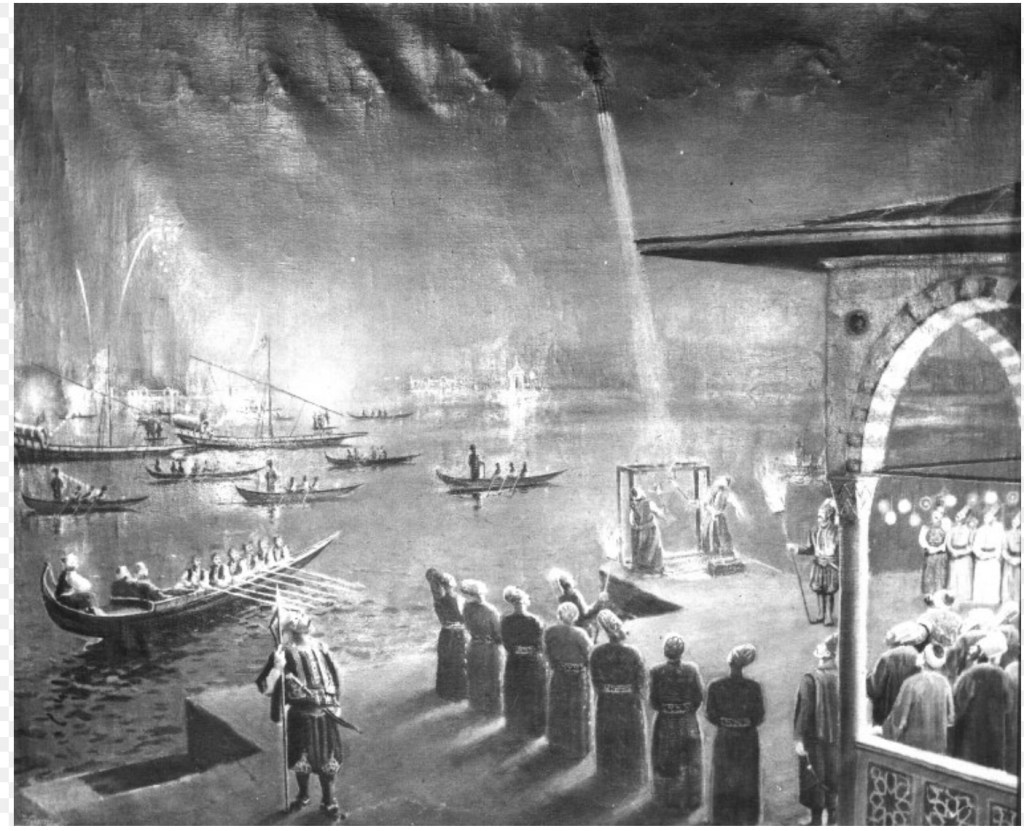
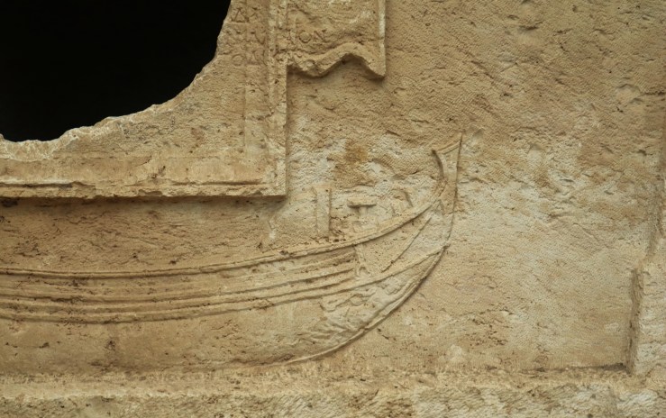
The Triremes

The mention of the military harbour had Ian and I both intrigued, so we did a little bit of googling. The boat of choice for all trend setting marauding forces was a trireme. You’ll probably recognise the picture below even if you don’t recognise the name “trireme”. They were most effective in the shallow waters of the Aegean Sea.

General Thucydides* outlined the specs for a trireme as having 170 oarsmen in three tiers along each side of the vessel—31 in the top tier, twenty-seven in the middle, and twenty-seven in the bottom. The boats were made of a thin shell of planks joined edge-to-edge and then stiffened by a keel and diagonal ribs. Each squared rigged trireme displaced only forty tons on an overall length of approximately 120 feet and a beam of eighteen feet. They were capable of reaching speeds greater than seven knots (13 km/hr) under sail. During battle the rowers were known to reach speeds as fast as nine knots **. The triremes were equipped bronze-clad rams, attached to the keel at or below the waterline; these were designed to pierce the light hulls of enemy warships. They could also be dismantled for transportation and/or destruction rendering them unusable for enemy forces.

According Thucydides tributes (or taxes) for trireme protection was calculated based on the following: 1 trireme = 200 rowers = ½ talent per month. A flotilla of ten triremes required an outlay of thirty talents for a typical 6-month sailing season. A talent was a unit of weight used to gold, silver and other precious goods. A trireme crew of 200 rowers was paid a talent for a month’s worth of work, which equated to 4.3 grams of silver per rower per day. According to wage rates from 377 BCE, a talent was the value of nine man-years of skilled work. This corresponds to 2340 work days or 11.1 grams of silver per worker per workday.

* Thucydides (circa 455 – 398 BCE), was an Athenian general who wrote a contemporary history of the wars between Athens and Sparta. **For comparison Longo weighs “just” 13 tons is fifty feet long and we average around six knots under sail however we’ve gone over nine knots on occasion. And I can confirm that our crew will never row her anywhere, anytime!”

The mairtime bumper cars of the ancient world!

As triremes were made of wood, they needed constant maintenance and care due to rot and damage from marine life. Tar and pitch were used as an antifouling and waterproofing coat providing protection from the harsh sea environment. Nonetheless they did not last well in open waters and were likely to succumb to extreme weather (like Meltemis). Consequently, it was regular practice to haul out the boats for extended periods even when far from home. From all of this I postulate that the triremes and their navies were the original cruisers and live aboards of the Med! I can only imagine the deck parties, BBQs, and general mayhem they would have caused to the local communities.

The Wonders No Longer there

Anyone who has ever been to the British Museum is likely to have seen an impressive sculpture known as the Lion of Knidos. This marble from which lion was carved comes from Mount Pendelikon near Athens and is the same kind that’s found in the Parthenon. That’s about 700 km away from its original home in Knidos. It’s hollow so it only weighs six tonnes, and measures 2.89 metres long and 1.82 metres high. There is a theory that it was part of a monument to commemorate the Battle of Cnidus, mentioned above. While it would make great reading in this post, it isn’t likely to be true as the British Museum estimates its age as somewhere between 200-250 BCE, some two hundred years after the battle. The rest of the monument which is still in Knidos has no definitive inscriptions to confirm the lion’s age or its purpose.

The lion was first “discovered” by Richard Popplewell Pullan (what a name!) in 1858 and he had it shipped to London (about 3,600 km away from Knidos) along with a life-sized marble statue of Demeter, the goddess of agriculture and of fertility dating to around 350 BCE. Demeter was the mother of Persephone, the Queen of the Underworld. An agreement made between Demeter and Hades, Persephone’s husband, to “share” Persephone. Under this agreement Persephone lives six months of the year with Demeter and six months with Hades. When Persephone is above ground with her Mum Demeter is happy: the sun shines, the crops crow and the birds and bees make merry. When Persephone is with her husband in the underworld, Demeter weeps and the world weeps with her. This story forms the basis of the Ancient Greek understanding of the seasons.

Another famous statue from Knidos depicted Aphrodite (only a Roman copy remains). Phryne of Thespiae, the model for this statue is said to have won against a charge of impiety, for participating in an orgy while partaking in ‘shrooms’. In support of her defence, she disrobed before the court. Her naked beauty so struck the judges that they acquitted her of all charges. I think Phryne incapsulates it all – beauty, brains, outrageousness, fun and self confidence. She’s my newest hero!

I have yet to make it to the British Musuem; these photos are all open sourced from the internet. The last one is a depiction of the Knidos Aphrodite taken from records near the time of its creation. The original was destroyed however Roman copy of this statue still exists of Phyrne as Aphrodite but it’s only a tribute.

In 2008, Datça petitioned the British Museum for the return of both the Lion and Demeter. However, I guess the British Museum responded with a heartfelt “finders’ keepers” * since both still are in the UK. I will say though that we found a shard of pottery with a geometric pattern stamped upon it and many amphorae handle shards and pieces of painted pottery that looked like plates and bowls, strewn all over the site. Being good law-abiding visitors, we left them where we found them, except the geometric patterned piece which we placed with other pieces near the entrance.

*This is meant as humour and not a statement about who should have possession of these valuable historical artefacts. That’s a conversation I would prefer to have with an English gin and tonic in one hand and a Turkish raki in the other.

Farewell Türkiye in more ways than one

We returned to Datça to sit out a bit of a blow (aka another Meltemi) watching the local turtles and stand-up paddle boarders (SUPS) battle with the frothy swell and challenging winds. On a serious note, two girls around 11 or 12 were playing near the shore which was sheltered from the twenty-five knot winds. Once they ventured a little too far out the wind caught them, and they couldn’t make headway back toward the shore. Their stricken fathers were running along a nearby headland, but they couldn’t keep pace. Thankfully, they passed near Ray’s boat, and he heard the girls screams while he was below decks. He popped his head up in time to see them disappearing out to sea. Thankfully, a quick launch of the rescue dinghy returned the girls to their family on the beach. Ray was a little unhappy that they were blissfully ignorant to the fact it was only by chance that these two girls didn’t lose their lives.

Finally, the wind abated and our time at Datça, indeed Türkiye, came to an end and on a warm summer’s day. We paid a nice man to walk our papers through the Turkish bureaucratic processes before slipping our lines and sailing the 13 nm (24 km) across the Big Blue Wobbly to Symi, in Greece. This trip took us about two hours and was completely uneventful, except for me scrambling to change our Turkish flag for the Greek flag as the Hellenic Coast Guard went by. I was going to write about Symi, our first Greek port, in this post as well, but I suspect you’ve finished your coffee and are keen to be doing more interesting stuff. So, I will say fair winds and a dearth of sea monsters until we next meet. However, for those who might recognise the name of the island – Symi, yes this is the island where Dr Mosely sadly decided to take the long way home.

How the Wind Blows

Hello, welcome, come aboard. Oh, how the wind blows! The last month has been both joyful and frustrating. Since dropping Ned off, so that he can continue his journey to Copenhagen and then Vietnam, we have been plagued by the pernickety wind gods but at least we’ve had beautiful surrounds.

We headed back to Fethiye so that Ali and Ray on SV Chill could attend to some important upgrades to their dinghy and arch. Having work done on your boat in a non-English-speaking country, or more correctly in a country where you don’t speak the language, can be challenging. Ian uses a mixture of Google translate, technical drawings and interpretative dance. It works most of the time and when it doesn’t it’s very entertaining. Thankfully, SV Chill had an English-speaking agent helping with the negotiations, so Ian and Ray didn’t need to bust a move. Still as with all technical work there were complications and delays, but the outcome is spectacular and well worth the wait. They now have Red Rocket, a Highfields dinghy with a 20 HP outboard. Let the dinghy races begin! They also have an arch that supports solar panels and can stow Red Rocket safely for sailing.

In between this important work we hung out in Göcek National Park and Fethiye. We made the trip up to Käyakoy (see our blog of 30 May 23). I love this ghost town for its modern history, as sad as it is, and we were keen to share this mournful place with our mates on SV Chill. We eased the load by tagging on a trip to the stunning beach at Oludeniz. Where we had ice cream as we strolled along the foreshore watching paragliders attempt to land on the beach. These paragliders piqued our interest and we attempted to drive up the mountain to see these nutters take off. We made it about two-thirds of the way when we called it quits. There were buses full of tourists, Mama and Papa’s on their mopeds, and numerous late 70’s Russian sedans bravely or naively making this trip, these Turks are made of stronger metal than we were. I refused to get out of the car when we stopped to take in the view, as my fear of falling off* the mountain had taken over. So, only the photo, that Ian took.

*I’m not frightened of falling down the mountain but up off it. This irrational fear has something to do with not being closer to the centre of the earth and therefore gravity has less of a hold on me. And as I had no rock in my pocket weighing me down, I could not bring myself to get out of the sturdiness of the car. (Ron and Ned stopping laughing)

Dalyan and Kaunos

Once all was well and spiffy with SV Chill, and Red Rocket was stowed as safe as a safe thing, we decided to sail to Ekincik. It was from here that we took a river cruise up Dalyan Strait, with stops at Kaunos Anti Kenti and the Kaunos Tombs of Kings which overlook the pretty village, Dalyan. This was high on my list of places I wanted to see.

Kaunos was once a seaport but now lies seven kilometres inland due to earthquakes that caused the ports to silt up. Consequently, the town and much of the surrounding area was deserted after a breakout of malaria decimated the local population.

I’m glad we stopped but it wasn’t as noteworthy as I expected. Which made me ponder whether I am becoming jaded with all this history? I tried to discover an oddity or unusual snippet about this region’s past and came up somewhat wanting. Though legend has it that Kaunos was named after a man who ran away from home to escape his sister’s romantic advances! The legend doesn’t say whether he ran away because her desires were morally corrupt or if he just wasn’t feelin’ the love? This restored my faith sufficiently for me to continue with my visits to ruins in search of the quirky, magical, and downright loopy factoids that keep me entertained and out of Ian’s hair. (Mind you it’s not hard to keep anything out of Ian’s hair)

Unusually, these ruins are quite lush with shady olive trees and springy grass. There is work being done at the ruins to give a better idea of how some of buildings would have been originally. The stone work is quite spectacular with detailed carvings.

Dalyan is a lovely little village, and the King’s Tombs are impressive. These tombs are not dissimilar to the Lycian tombs in Fethiye and were built between 5-2 centuries BCE. There are more than 150 rock-cut tombs, twenty of them have temple-type façades which suggest they were the Kaunosian Kings’ tomb and these feature Hellenic Columns and such. Many are smaller, simpler, and designed only to hold cremation urns and/or bones. The grandest tomb is only partly completed, and it’s believed that this was due to the lack of gin and tonics at the time. The carvers started from the top and were working down, which gives it the appearance of an image stalled on a computer.

The photos on left show the impressive tombs. In the middle photo you can see the partially completed tomb. The tombs at the bottom were for the not-so VIPs might have had their bones or ashes stored in.
The handsome, relaxed gent top right, is Ray. Ray is recently retired, can you tell? We had a lovely lunch in Datça.

The highlight of the day for me was the trip along the Dalyan Strait on the quaint river boat, “not unlike the boat in the African Queen” but really nothing at all like it. Dalyan means “fishing weir” in Turkish. Bass, Mullet, and Sea Bream swim upstream through the strait to Köyceğiz Lake to breed. Along the strait there are permanent fish nets called dalyans with fishing shanties alongside. Due to the profusion of fish the area is also a turtle-urtle (scientific name for the common turtle) breeding ground. According to the information provided on the boat there are three kinds of turtle-urtles: “the caretta-caretta which is a pradator, the chelonia mydas is a wegetarian, and the other one is the river nile turtle”. I was keen to see a turtle-urtle and was beginning to despair when in the last few minutes leaving the strait I caught a glimpse of a big ol’boy coming up for air; not sure if he was a pradator, wegetarian or river nile type though.

The Datça strait.

Weathering the Weather

While in Ekincik, the weather forecast predicted some stronger north-westerly winds for the coming days. Interpreting the weather forecasts can be further complicated as they don’t always adequately reflect the effects of local land features. Though not so important when sailing it’s crucial when choosing an anchorage during high winds. When I try to read the forecasts, I feel I should be donning my floaty skirt and bangles like a fortune teller before trying to read someone else’s tarot cards. Whereas Ian has years of experience in reading the weather and an understanding of the isolated effects of local terrain, so I have normally left this mystery to Ian.

We have plenty of tools to help with these decisions: three weather Apps, with nine weather models (some twice), displayed in a variety of ways. Is this too many? Yes, we generally use one called Windy (.com not .app) and rely mostly on one model (ECMWF). It seems to us to be the most consistent and conservative, it almost always shows the highest predicted wind strengths, and means we are preparing for the worse rather than hoping for the best. In the beginning we looked at all the models and deliberated and worried, but this only caused me anxiety. Then dealing with my anxiety causes Ian consternation, so for a long time I’ve only used the other Apps and models sparingly as validation tools. Ian also looks at google earth to get a feel for the surrounding land masses when we are picking anchorages.

We also consult our electronic charts for anchorage info such as depth and obstacles and the Bibles of Anchorages, Navily and No Foreign Lands, for up-to-date information on what human comforts are nearby. Trust me there is nothing worse that being stuck on the boat in an anchorage without the confidence to go ashore or somewhere to go even if you can get ashore. How do we know? Five days riding out high winds stuck on the boat beneath a mine site on the back end of a Greek Island. Not something either of us want to do again.

1. Windy.com weather map with general wind and weather detail. It will also show is swell; nobody likes a bumpy ride.
2. On Windy these pretty pinks and purples are a sure sign that we will be anchored somewhere save preferably with a nice big mountain between us and the very strong winds they represent.
3. These are some not all of my boating Apps.
4. This is Navionics on my phone. It replicates our navigation on the charter plotter on the boat. It’s the modern sailors charts and maps. Rightly or wrongly we don’t have physical maps on board … at the moment. We can both use them and when we go for long off shore trip, like crossing the Atlantic, we will consider having them on board as a redundancy. At the moment our connectivity does not warrant physical maps.
5. Finally this picture is from Navily and gives you an idea on just how many anchorages, ports and marinas we have to choose. So much to see, and so much time to do it in.

So before leaving Ekincik, the crews of SV Longo and SV Chill convened a war counsel to determine a safe place to hole up until the pernicious wind gods blew out their idjits. Idjits are not related to idiots but that icky jittery feel you sometimes get when stupendously bored. I do sometimes wonder if the wind gods are idjits idiots.

Lately, I’ve been trying to help out more with trip planning and anchorage choice, so I took a seat at the big kid’s table, and I didn’t even don my skirt and bangles.

Serce Limani (Sparrow’s Bay)

Our chosen bolt hole is called Serce Limani or Sparrow’s Bay. It has a narrow entrance that opens out into a nice T shaped cove surrounded by hills. We decided to take up a mooring ball outside of Captain Nemo’s, a rustic restaurant. It’s been a while since used a mooring ball and a first for SV Chill, but the staff of the restaurant gave us a hand, and it all went without a hitch. When the winds came in, we listened to it howl over the tops of the hills snug in the knowledge that we were safe. I helped pick this spot, so I was feeling a bit pleased with myself.

The cost of the mooring was a meal at the restaurant and as it was still early in the season, Captain Nemo was happy for us to stay a few nights even though we only ate there once. The food was simple, the beer was good, and the anchorage very safe.

Before the big winds hit, Ian, Ali and I decided to take a hike over to the next anchorage which is one of Ian and my favourites coves in Tϋrkiye. The cover photo of our blog pages shows Longo sitting pretty tied back to the shore of this cove.

We were halfway up the hill on our walk when Ali, said from behind me in her very calm English accent “there’s a snake”. My exclamations of alarm and wild gesticulations must have been comical compared to her calm utterance. When she pointed over to the other side of the ravine to a cluster of dried weeds that was madly shaking, I calmed a little, perhaps it was leaving. A moment later not one but two snakes locked in mortal combat reared up out of the grass, my nerves kicked into overdrive notwithstanding the distance and deep ravine between us and the snakes. The display was impressive and terrifying. I wasn’t taking my eyes of the snakes to grab my phone, but Ian tried to get video. Unfortunately, it looks those photos of the Loch Ness or Big Foot, so you’ll just have to take our word for it – they were huge snakes, with ten-foot fangs and ready to stop their fight and join forces to attack us. Meanwhile the three of us stood transfixed for what seemed like hours but was likely a minute or so, I suspect the others were watching the spectacle, I was panicking.

I had read somewhere that Turkey had only a couple of types of snakes and that they were mostly timid or harmless. As a consequence, I’d started to feel safe and allowed my natural Aussie born and bred fear of all things bitey to weaken. Finally, those instincts came rushing back with a vengeance and I announced “nope! Just nope. I’m done, time to leave”. Unsurprisingly neither Ali or even Ian questioned my decision, and we trooped back down the hill to the dinghy. Later, Ali and I both did some research and separately came up with the fact that there are LOTS of snakes in Turkey (well duh!) and that these feisty ones were most like Ottoman Vipers and yes, they are venomous. They might not kill you as fast as some of our Aussie snakes but your chances of coming out of an encounter breathing when you live on a boat moored in an isolated anchorage is not good.

The Ottoman Viper!

Finally, our pulses and the weather slowed enough for us set out on our next adventure.

Bozburun

Our next port of call was the town of Bozburun, another quaint village with a couple of nice safe anchorages protected from the North-West by large hills. Ian insisted we, he and I, had been here on our first trip along the Turkish coast but I had no recollection of the town and no photos to help jog my memory. It wasn’t until we dinghied into town and were walking through a kid’s playground that I said “that’s right! I had a melt down on that stone fence over there. You were trying to sort out fuel, a pump out and water at the harbour”. Ian held his own counsel on this remembrance as he’s a wise man with years of experience.

Last time we visited Bozburun, we were tired beyond belief. We had just sailed from France to Turkey in too short a time, suffering our first Meltemi stuck on the boat for five days, had a mainsail car break leaving us with only our foresail to work with and then only just scrapping through the Turkish check in (with only two days left on our European Schengen time). We were looking forward to a few nights in the marine but the agent confessed they had forgotten to book it as promised and so we had to bugger off as there was space available. There’s an exceptionally long post about this trip somewhere. Bozburun was only our second anchorage in Tϋrkiye.

My meltdown while sitting on that stone fence was because of the dreaded Turkish black water pump out regulations. These regulations require boats to hold their black water (i.e. what goes down the loo) in a tank “for safe keeping”, I mean disposal. This tank is pumped out every couple of weeks at a marina. The principle of these regulations is noble, it’s supposed to protect the beautiful clear turquoise waters we all enjoy sailing. The reality is vastly different. Our observation is that these regs only to apply to foreign boats and not the local tourist boats or big gϋlets. Not unreasonably we are required to pay for these pump outs. The cost varies, our most recent one being 1,000TL (about AUD50.00). The cost of this service is determined by the volume in your tank.

We’ve had successful pump outs where they pump out the entire contents of holding tank, tell us how much they’ve pumped, we get our blue card updated, the official record of the pump out, we pay and go on our merry way. We’ve had partially successful pump outs, where they try to pump out or pump out some of the contents but not all and tell us how much etc etc. Or before doing the pump out they ask us how much they are going to pump out because we all know how many litres we flush, right? We’ve learned that if we say anything less than 50 litres it’s cheaper. Finally, there are the virtual pump outs, where you take a guess at how much you’ve been carrying around for the last how-ever many days, pay the arbitrarily determined fee, receive your all-important blue card tick, and go on your merry way without every having seen a pump out machine.

No matter which kind of pump out you’ve had the next time you’re out on the big blue wobbly, you do what the locals do and release the Kraken*. The Coast Guard are the enforcers and will fine you, sometimes thousands of dollars if they catch you or if you don’t have evidence (the blue card tick and receipts) of pump outs every 14 days. This time allocation is regardless of your tank capacity or how many onboard. *The kraken is what we affectionately call the contents of our holding tanks.

Before continuing I have to say just how proud I am of myself for getting through that without once using the word “poo” once! Shit, I’m good!!

So, the first time we were in Bozburun, I was stressing as we had just been told we couldn’t get a pump out. It hadn’t even been five days and we weren’t due, but in my tired, overwhelmed state it was just too much for me. I will go a long way to keep within the rules. I have given up trying to defend myself against Ian’s claim that I have “good girl syndrome” because he’s right. I’m the overly conservative yin to his mischievous yang. Ian isn’t one to break important rules, but he is more than willing to “adopt local customs”; when in Rome and all that.

This was the memory I had when I saw that little stone fence in Bozburun. Having identified the cause of the blackhole in my memory and relishing how relaxed I’d become; I was now free to fill the space with wonderful memories of a sleepy village loved by the locals.

This is Ali, Ray’s partner. Ali is also recently retired! Can you tell? The delicious and beautiful mezze platter was courtesy of Ozman’s in Bozburun.

Sticking to our promise to go slow this year, we hung around for several days just living. Ray and Ali had some bibs and bobs that they needed to do on SV Chill so they took up a berth along the town quay, while we hung out in the anchorage. We met some two and four legged locals. There’s a wonderful restaurant called Osman’s Place, the chef speaks brilliant English and is always happy to have a chat about the region, his time on boats and to help wherever he can. The restaurant even has shower facilities available to us salty seadogs. There was also the quaint laundry service that lowered our washing from a second-floor window using a long rope. There’s even a decent cup of coffee at one of the many cafes and the local market was small but had everything we needed.

When the strong northerly wind came through, we treated ourselves to that guilty pleasure known as schadenfreude as we watched a couple of late arriving charter boats try to anchor and then opt for taking a berth in port. At one point they, one a smallish monohull, and the other a larger cat, were vying for the same berth; the cat won. The mono found a spot but only after he laid his anchor in an interesting right hand turn which had us wondering who he might have overlayed. For the record, We’re not total assholes. When we can we help, we’ll pop the dinghy down and Ian will don the Bundy rescue hat then zoom off to help guide a boat that has trouble. Like most sailors we know we’ll help with docking, tying lines and such, we’ll take lines ashore, offer advice or give a boat a bump to help get it in place. On this occasion there was nothing we could do to help and besides, it was gusty so having the dinghy in the water would not have been safe for us or the other boats. The boats were not in that much danger other than from the actions of their captains. They were both charter boats so hopefully they had comprehensive insurance.

I guess a time will come when our wrongdoings and misdemeanours are weighed against our honourable deeds, and our schadenfreude on this day will be just another grain of sand on the scales. I hear Lucifer holds all the best eternal parties “down below” anyway.

With that I bid you farewell until next time. May your seas be calm, your winds fair and there be a dearth of sea monster for your journey ahead and no mammoth snakes with ten-foot fangs duelling it out in your path.

A very busy Saint & his Guardians of the Big Blue Wobbly

Hello, welcome, come aboard. You recall from our last post that we had loaded up Longo with enough food to last another day or two, and we had motored on down to one of my favourite places in world. From a sailing point of view, the weather hasn’t been particularly kind to us, but what we’ve lacked in wind we’ve picked up in mild days filled with sun. Those that have sailed the Turkish Coast will know of Gemiler Adasi or Camel Island and its rich history and unique anchorage opportunities. Warning: There are secrets herein that are not for kidlets.

Gemiler Adasi is a small bat shaped island (at least on the map) just a few short hours from Fethiye. Ian and I have now been here three times, once on our own and then twice to show off the island to family and friends. This time we were showing Ned this wonderful place and we were met by SV Soultrain and of course SV Chill came along.

1. Hard not to love a place with sunsets like this!
2. Me and Ian on our first visit almost 18 months ago.
3. Ian with Charlie and Megan on our second trip last year
4. Ian and Ned this trip. They each speared a fish. We didn’t eat the lion fish (the red one which has nasty spines) but we did fry Ned’s catch and it was a delicious morsel.
5. Ray and Ali still look like they are loving their new floating life
6. Amanda and Trevor from SV Soultrain and Karon from SV Sea Dreamer.

Anchoring at Gemiler Adasi is very special. All boats Med moor (also known as lines ashore) to the island or the main land, which is just 200 metres across the channel. Med mooring means in addition to dropping the anchor you tie back two lines to rocks or bollards on the shore. The benefits of this configuration is that it offers stability from the swell and wind, and it keeps the boats neatly out of channels and thoroughfares. More importantly you have your very own little Med pool between your lines, where you can swim, snorkel and float about. Of course many folk will happily swim, kayak, SUP and dinghy right through your little haven, lifting your lines as they go. It’s a great way to meet people. Many sailors hate Med mooring, as it’s a bit of a nuisance to set up. Someone has to go to shore with extra-long lines and tie them to something solid enough to take on the job of holding your boat steady in a strong wind. On Longo this job is mine. Some brave souls dive off the back of their boats with lines over their shoulder and swim ashore. Others use SUPs. After watching many professional gulets, we have opted for me taking the dinghy to shore, complete with all the lines. I then secure the lines using chains to a rock, bollard of on rare occasions a tree stump (never a living tree) and then driving the dinghy back to Longo trailing the lines in the water. This often requires me to scramble over slippery and ragged rocks. I feel quite the adventure girl, with my handy multi-tool, flinging chains and ropes around. Meanwhile Ian drops the anchor on Longo and reverses back to meet me. This works for us as it gives me plenty of time to find a good solid spot to tie to without Longo hanging on the chain at the mercy of the wind. This is especially important as you are often in close proximity to other boats also tied back. This process also keeps the floating lines under control and away from Longo’s prop and as Grand Petit Bateau (GPB, Our tender) has a depth sounder so I can give Ian depth details via our walkie talkies, reducing the risks of Longo’s keel getting a good polish. It’s taken me a long time to get my technique down but the last couple of times have gone well. Let’s hope I’ve not now jinxed myself. During our most recent trip to Gemiler Adasi it was even easier as Ned came along with me. Having our Monkey Boy’s hands were very welcome especially when it means I don’t have to get wet getting in and out of GPB.

Back to why Med mooring at Gemiler Adasi is so special, other than having Ned along helping, of course! Gemiler Adasi has substantial ruins right down to the water’s edge and is the only place we’ve been where it is acceptable to tie back to those ruins. The same ruins where square riggers docked on their way to the crusades. Where we were positioned there were underwater ruins less than ten feet from the transom (back of the boat) with fish swimming among them and Ned spent an afternoon trying to spear a squid just off the side of the boat.

Our visit was very peaceful compared to the height of the season (June, July, August) where boats fill both sides of the channel and obnoxious pirate Gulets thread their noisy way between playing very bad 80’s or Turkish music (which is also probably 80’s music). To top this there is a jet boat that weaves among the anchoring boats pulling donuts of inebriated thrill seekers behind. There’s also the Pappa and Mumma in their little traditional boat offering to help with your lines for a small fee; they also sell homemade bread. The tourists are vomited out of these boats to swim and explore the island for an hour or two, then they are summoned back onboard by an almighty horn, and thus they leave us in solitude until the next boat arrives. Many hate this aspect of the island. I did the first time we were there. Now I see it as part of the atmosphere of the region. Of course, I’d still hate it if it wasn’t for the fact that the Gulets and other day boats all leave by mid-afternoon, and we are left we the solitude of an amazing location with stunning sunsets and sunrises.

All of this is marvellous and worth the visit but for me it’s the ruins on the island and their rich history that makes this place so special. I suppose given my previous posts that won’t surprise most of you. If nothing else gives away why these ruins are so special its English nickname will. You see this island is known as St Nick’s island. And yes, it’s that “Saint Nicholas”!

The island has ruins dating back to 4th – 6th CE and include five Greek churches and a 350 metre covered processional walkway. The walkway was built because the monks weren’t keen on getting cold and wet on their way to and from church. There are also over forty ecclesiastical buildings and fifty odd tombs, littered throughout the island.

1. See below for why this beautiful chursh hewn from the stony island is so important!
2. An example of the pirate boats that bring their slaves (I mean tourists) to the island
3. Ian and Ned can’t resist a chance to get up close and personal with history
4. The ruins and historical aretfacts are so plentiful that many are left to the elements.
5. A section of the covered walkway. The walkway is decorated with a simple fish pattern or perhaps it is the ubiquitous Evil Eye you see everywhere in Türkiye and Greece (however that might be a bit pagan for the ol’ monks)
6. Another of the churches. This one has an painted icon still visible on the wall. It has been defaced but otherwise it is quite clear

There are records indicating that the island was used as a stopover for pilgrims on their way to the Holy Lands. I’ve just finished reading an excellent book, called the Order about the Knights of St John of Rhodes (Hospitallers). The Knights were pushed back to Malta where they successfully defended the island from the Ottoman hordes in 1565. This book suggests that the siege of Malta began as retaliation for the knights capturing the Suleiman the Magnificient*, the Ottoman ruler’s flag ship called the Sultana. This great sea battle was said to have occurred just of the coast of this little island and the reason the knights were successful was because they hid their fleet in the very same channel that our little boat was moored. The knights waited for the Ottoman fleet to pass by and attacked the smaller weaker boats at the back of the fleet leaving the Sultana’s flank unprotected and given her size she was unable to manoeuvre to protect herself with the enormous canons that she carried. Consequently, the Knight’s were able to take the Sulatan and her booty for their own.

If tales of knights, sea battles and such is not enough, I can take you back even further into history, to explain the origins of the English nickname for the island.

If I had been asked before coming to Tϋrkiye where St Nick came from I would have said one of the Nordic countries. The image in my head of old St Nick, is the one with the long beard and robes decked out with furs and a long wooden walking stick. Kind of like, Gandalf on a winter’s day. I didn’t realise how wrong I could be. St Nicholas and was of Greek decent, likely of dark or olive complexion but he probably had an impressive white beard when he died. He was born in the maritime city of Patara in Anatolia (part of the modern day Antalya Province, not far from the lovely town of Kas, Tϋrkiye). He is believed to have lived between 270CE and 343CE. Making him 73 years of age when he died which is very old for the time period. St Nick is also known as St Nick Of Myra (in Tϋrkiye) and St Nick of Bari of Italy (where most of his bones are located**) and more delightfully as Nicholas the Wonderworker!

Ol’ St Nick was a busy man. He is the patron saint of merchants, archers, repentant thieves, children, brewers, pawnbrokers, toymakers, unmarried people, students and, in one academic source, prostitutes. Second most importantly (after children not the prostitutes) he is also the patron saint of sailors. So if you are an unmarried cabin boy, with a profitable brewery on the side, who likes to whittle toys of other kidlets when not learning more about the economic benefits of expanding into money lending and pimping, then St Nick is your go to Saint for all your spiritual needs. Am I going on the naughty list for this?

Of course, you don’t become a Saint without delivering on the miracles and St Nick is said to have done his bit, though some of his “miracles” are less miraculous and more virtuous deeds. My favourite two stories are:

  1. There is painted and written evidence to suggest that St Nick saved three young girls from prostitution. Their father was so poor that he was unable to provide dowries and no alternative than to “sell” his daughters to pay his debts. St Nick felt that this was unacceptable. However, the proud father would not accept charity openly, so the crafty Saint crept up to the families house in the dead of night and threw through a window in a bag of coins sufficient to pay a dowry for the first daughter.  Once she was married off, he did this twice more for her little sisters. The father of the girls caught St Nick in the act of providing the third bag of coins. And there you have it! The basis for the tradition of some crazy old mystical dude coming into your home in the dead of the night and giving your children presents.
  2. While the story of the three girls is delightful and it answers a question, I didn’t know I wanted to ask. The next story is just outright bizarrely cool. There is a tradition of painting St Nick standing over three small children who are standing in a cauldron over a hearty fire. The kidlets are looking up at St Nick with love and adoration. That’s because St Nick saved these kidlet’s from a fate worse than a fate worse than death! The story goes that St Nick happened upon a butcher who had few wares to sell due to a famine. He “obtained” three kidlets that he decided to pickle and cook, and then sell as bacon. St Nick was not impressed and apparently brought the kidlets back to life despite them having already been pickled and spirited them away before the butcher was aware of what was happening. Lover of kidlets and good quality ethically sourced bacon. My kind of Saint!

St Nick is one of the most revered and renowned Saints in Christendom. There is a great deal of evidence to show that St Nick’s relics (I.e. his bones) are the most well documented and are scattered across Europe. According to carbon dating those in Bari and the UK (I think) are most likely to be the actual bones of the Saint himself. More often than not Saintly relics have been shown to be medieval fakes.

I guess you’re wondering what all this talk of St Nick has to do with Gemiler Adasi. Or maybe you’ve already figured out and I don’t need to say he was said to have lived on the island. In addition, according to writings at the time, this was where he was also originally burried. There is a church hewn from solid stone on the highest point of the island (the big one in the first picutre above). To protect St NIck’s bones from desecration by the invaders, they were moved to Myra (now known as Demre), on the mainland south of Gemiler Island. In 1087 they were moved again to Bari in Italy where many of them still remian in the Basilica of San Nicola (this move was without the permission of the appropriate ecclesiastical bureaucrat responsible for them); subsequent to this some of the relics were taken to Venice during the first crusades.

1. This painting is closer to what St Nicholas actually looked like, given his heritage than how we are used to seeing him.
2. This beautiful painting is Russian.
3. St Nick saving the pickled kidlets (I wonder if when they say “pickled” they mean in brine or that the toddlers were stonkered? If it was the second then St Nick may actually have evented the only hangover cure that may have actually worked!)
4. These three lovelies must have been very grateful to Saint Nik that their father was able to pay a dowry to their husband rather than the ladies being paid to service men.

There are paths all across the island you can follow that take you to most of the interesting places and there isn’t much you aren’t allowed to see or touch (except some fine mosaic floors in St Nick’s church at the top of the island and few places deemed unsafe).  Gemiler Adasi in Spring is stunning, there are poppies and other wildflowers blooming everywhere throughout the ruins. There’s even a stray cat that lives on the island and plenty of bird song that livens the morning air. I’d like to think that at some point in my three visits I’ve touch a stone wall or walked a path that St Nick might have once touched or walked.

In future I would advocate leaving out Ol’ St Nick a nice strong Turkish coffee or maybe the ubiquitous chai and a slice of Turkish Delight or perhaps Baclava. 

To put the cherry on top of our time at Gemiler Adasi, during our trip back to Fethiye, we were treated to the longest and most spectactular visit from St Nick, Patron Saint of Sailors, Guardians of the Big Blue Wobbly, aka dolphins, that we have ever seen. Two of these beautiful creatures joined our boat shortly after we hit the open sea and they stayed with us for a staggering half hour or so. During that time they cruised along our bow, darting off ahead to do back flips and skip along the swell. They were clearly playing and showing off. After every feat they would return to the boat and roll on their sides to look up at; you could all but hear the “did ya see that!” Finally they darted off. probably to hunt out a nearby school of fish.. Even their departure was impressive in its synchronicity and speed (probably twice as fast as our boat speed).

It’s a rare ocassion when we have time to take photos of dolphins. We’ve leared to run to the bow as fast as we can without grabbing phones or camera because you just never know how long they will stay (making sure the boat is safe and Britney Steers is on, first of course). I revert into a gibbering squeally mess. I talk to dolphins like they are cute babies, kittens or puppies. These are incredibly smart creatues* who likely look up at me and laugh at the blubbering idiot. I don’t care!
*If you doubt the smarts of dolphins I recommend you read “Hitchiker’s Guide to Galaxy” by Douglas Adams.

I normally leave you with fair winds and a dearth of sea monsters but today I think I will add the blessing of Saint Nicholas, the Patron Saint of sailors and children (for I like to think that we should all be young at heart).

*Suleiman’s full title: Suleiman the Magnificent, Sultan of the Ottomans, Commander of the Faithful, Shadow of God on Earth, Protector of the Holy Cities of Mecca, Medina and Jerusalem, Lord of Lords of the World East and West. I suspect his mother called him Sully when he was good and just Suleiman the Wicked when he was a naughty boy.

** the location of St Nick’s bones this has been confirmed through historical records.

Pilots and Masons, the wisemen of Constantinople – Part III of Istanbul.

Hello, welcome, come aboard. Today’s blog rounds out our adventures in Istanbul. It truly was a once in a lifetime adventure and somewhere I never envisaged myself visiting. We are now just beginning our adventures in Greece, which includes a visit from Ron, Marissa and our little Charlie Love. In the meantime, here is Part III of our adventures in Istanbul. I will also write about our adventures in the Marmara Sea including our visit to Gallipoli soon but first meet Taksim Square and Fener-Balat.

Taksim Square and Galata Tower: Ian had some very important boat job that required him to head down to a suburb that wouldn’t rank on the top 100 places to visit in Istanbul. Thankfully Janine and Craig of SV Inelsamo invited me to tag along on their visit to Taksim Square. So I ditched Ian’s adventure to nowhere and went off to explore with our friends. Janine and Craig had visited Taksim Square before and were the very best tour guides. We ferried across the Bosphorus, then hopped on the Füniküler* that takes you to the top of the hill. *Fun-nik-ul-er; now there’s a word, it clatters over your tongue like a mouth full of lego.

Taksim Square is on the European side of Istanbul and I wasreliably told that it was less touristy than where all the big icons are in old Town. It was still touristy, just less so. A little like comparing the Sunshine Coast with the Gold Coast. For non-Australians apologies for the local reference, please transpose two of your own holiday locations where one is sheer bloody madness and the other is just madness.

Taksim means “division” in Arabic. In times gone by all the water sources for the European side of Istanbul converged here before being funneled of to other parts of the city. Nowadays this impressive square is the heart of the local Istanbul life. The square is lovely but I think Janine and I really started to enjoy ourselves as we walked along İstiklal Caddesi (Independence Avenue), a long pedestrian shopping street, that begins at the Square and leads down the hill towards the Galata Tower and on to delightful laneways that end at the Golden Horn.

Independence Avenue is much like any big city mall. We recognised many shops, name brands and takeaway joints. The significent difference, from the malls in Australia, were the stately vintage buildings. It was still a public holiday so there was a chilled vibe to the pedestrians, local and tourists alike. Janine and I shopped while Craig patiently wandered ahead. It was such a lovely “normal” day. Shopping with friends, trying on clothes, stopping for a bite to eat. Normal from our old life, one of those normal things that you miss only when you return to it after a while.

Along the way we stopped to view the Galata Tower. The original tower was built during Byzantine period (527-565 CE). This poor building has had a somewhat traumatic existence! It was destroyed by fire and folk alike, rebuilt, repurposed, and forgotten by just about every occupier of Byzantium-Constantinople-Istanbul. It’s been a fortified watchtower, fire watch tower, prison, religious sanctuary and more recently a museum. In doing my research into the Tower’s history I came across this quirky little tid-bit, which is just too good not to share.

Hezârfen Ahmed Çelebi, (1609 – 1640) was an Ottoman scientist, inventor, chemist, astronomer, physician, Andalusi musician, and poet from Constantinople. According to one source* Hezârfen means “a thousand sciences” and the title was bestowed upon Ahmed as an acknowledgement of his wisdom. All this at the ripe old age of twenty-three. (Don’t you hate under-achievers!) Ahmed is credited, by at least one contemporary source, as having achieved sustained unpowered flight. He achieved this by strapping on a pair of wings and jumping off the Galata Tower. Remarkably he is said to have landed about 4 kilometres away, on the Asian side of the city. Making this the world’s first intercontinental flight, and the fourth sustained unpowered flight ever recorded. It’s said his inspiration came from the birds and Leonardo Da Vinci’s of course. *hezarfen-ahmet-celebi-the-first-man-to-fly

However being known for your wisdom in 1600 Constantinople was not… well… very wise. It seems that Sultan IV Murat decided our erstwhile genius was “somebody to be afraid of. Someone, who could get whatever he wants and therefore was somebody illicit”. Not wanting such greatest to overshadow him the Sultan gave Ahmed a bag of gold before sending into exile in Algeria where Ahmed died at the age of thirty-one.

Not to be outdone, Ahmed’s brother, Lagari Hasan Çelebi may have survived a flight on a seven winged rocket powered by gunpowder from Sarayburnu, the point below Topkapı Palace in Istanbul (1633). Lagari was obviously wiser than his brother as before launching his craft he joked with the Sultan Ahmet IV “Oh my Sultan! Be blessed, I am going to talk to Jesus!”. When Lagari landed in the sea he swam ashore and quipped “Oh my Sultan! Jesus sends his regards to you!”. For his efforts the Sultan gave him a bag of silver and the rank of Sipahi in the Ottoman army.

Courtesy of Wikipedia

I love a good conspiracy, and wonder if little brother, Lagari had a hand in his brother’s exile. There is after all no competition greater than that between siblings.

Unsurpringly Wikipedia suggests the authenticity of Evliya Çelebi, the Ottoman traveller who documented these events, may not have been reliable. To further erode the validity of an otherwise crackin’ good story in November 2009 Myth Busters tried to recreate Lagara’s flight. However, Evilyas account did not contain sufficient technical detail or the experiment to confirm or debunk claims. Myth Busters concluded that it would have been “extremely difficult” for a 17th-century figure, unequipped with modern steel alloys and welding, to land safely or even achieve thrust at all.

Eyüp and Fener-Balat Suburbs were our last grand adventure in Istanbul and it was one of my favorites for two reasons: it was somewhat unplanned and it was all about the ‘burbs. I’m being a tad cheeky saying this adventure was unplanned. Craig and Janine had a Plan A, Plan B and I think Plan C. These were based on the ferry timetables and our group desire for trekking. Plan B was taking the ferry up the Golden Horn (insert giggle here). There were some interesting sites along the Golden Horn, some beautiful and some downright curious. We left our ferry at the last stop in the municipality known as Eyüpsultanmet or Eyüp.

The crane is fully submerged up to its lifting arm. We aren’t sure if that’s intentional or whether someone had an oopsie.

Like the rest of the Istanbul habitation in the area dates back to the Byzantine era. There was a monastery (founded circa 480 CE), saints performing miracles (circa 518-565 CE and more in the 1200s ), some equally important civil wars, some seiges, a coup, attacks by crusaders, state meetings and visits by quite a few historical notables. So like the rest of Istanbul a place with a past and a character all of its own. The municipality has numerous churches and many more Mosques. The Eyüp Muslim cemetery is one of the oldest cemetries in Istanbul and which was very popular with sultans and other important dignitaries as the tomb of Ebu Eyyûb el-Ensarî (or in modern Turkish Eyüp Sultan). Ebu was close companion (sahaba) of Prophet Muhammad, he died during a raid against Constantinople and wanted to be buried as close as possible to the city walls.

The Eyüp we saw was a mix of old and new. More old than new with a definite working class feel to it. There was a lovely green park along the Golden Horn but it was overshadowed by major roads and shady backstreets. Not “drug lords, pimps and muggers” kind of shady. Though perhaps overnight? Who knows? Still the neighborhood had its charms at least in the daylight.

The white and grey pillars are grave markers.

We continued on our way and found ourselves in Fener-Balat. These were once the Jewish and the Greek quarters of Istanbul. In the mid 1500s Sultan Bayezid II offered citizenship to Jews and European Muslims fleeing the Inquisition in Spain and Africa, and the 1492 Alhambra Decree (forced expulsion of the Jewish population from Spain). Many of these refugees settled in Fener-Balat. However, Fener-Balat today is overwhelmingly Muslim, with most minority populations having left the district or were forced to leave as a result of the Armenian genocide and the Greek-Turkish “population exchange”.

These suburbs are an odd mix. The joyful sherbert hued buildings and the river create a pretty facade behind which lurks a dusty rabbit warren of mid-1800 and 1900 apartment buildings in varying states of disrepair. We came across the weekly pazari (fresh food market) in one back street. Going by the chatter that followed us through the market the locals were not accustomed to having tourist wander so far back in the suburb. They were friendly and curious though reserved. Other parts of the suburb are geared up for tourists with funky cafes, groovy shops and crazy curiosities.

Two notes:
1. The impressive red building is the Church of the Virgin Mary of the Mongols
2. I may have threatened Ian with the purchase of the sunflower ‘kini top and/or adoption the kitten. Ian was more concerned about the kitten than the top!

Throughout these suburbs there are remnants of the ancient Walls of Constantinople . These walls are some of the most substantial and long lasting defensive additions to Constantinople. The first walls were built by the Emperor Constantine. They are said to be “the last great fortification system of antiquity and one of the most complex and elaborate system ever built.” (wiki). Countless improvements, repairs and additions have been undertaken throughout history. While many of the ruins that remain date back to the Ottoman period, it is the double line of the Theodosian Walls built in the 1400s that are considered the penultimate defensive structures. At the height of their use these walls were impregnable. They withstood sieges by the Avar-Sassanian coalition, Arabs, Rus’, and Bulgars, among others. The introduction of gunpowder siege cannons being the only credible threat to the fortifications. The siege cannon used was 8m long and fired a 700kg projectile 2.5km, but it could achieve a maximum rate of fire of 3 rounds per day. Even this level of cannon technology was insufficient to capture the city on its own. Through a combined effort the walls were finally breached and Constantinople fell under the sheer weight of numbers of the Ottoman forces on 29 May 1453. (This willingness to accept incalculable deaths in order to achieve a goal is a recurring theme in Ottoman and Turkish history.)

The walls were largely maintained until the 1800s when the city outgrew its medieval boundaries, and sections were dismantled and repurposed. Despite lack of maintenance and wanton “recycling”, many parts of the walls are still standing today. In the 80’s a large-scale restoration program begun and the remnants are now mostly protected.

The segments of wall that we came across during our walk were well tended. They were “repaired” not “restored” using wooden frames to support crumbling parts of the structure. In other parts of Istanbul the walls are incorporated into more modern buildings. We saw numerous examples of modern houses being built on top of the ancient walls or have repurposed these walls as retaining walls.

It’s a little hard to see, but behind the scaffolding in the large picture remains of the Theodosian Wall have been removed so that the modern house behind can have a view of the Bosphorus.

It was a great day of adventuring, with lots of stops to eat, drink and be merry on the way. It ended with Ian attempting to drag us back to see his fireworks dealer. However, the heat and crowds of the Bazaar bested us and we headed back to our floating homes.

Not long after this we moved on to the satellite town of Yalova where we encountered the dreaded pterodactyl but that’s a story for our next post.

Fair winds and a dearth of sea monsters on your travels through life.

Kayaköy – Modern Day Ghost Town

Hello, welcome come aboard. This post is the longest I’ve written. I had a lot to say and while I have tried to keep my thoughts brief, WordPress tells me you’ll need a cuppa and snack or given this is not my usual light reading perhaps a nice single malt whiskey. If you’re only interested in pretty pictures of ruins, I suggest you stop reading at the *. If you would like to know why the ruins exist, read on however I warn you there’s politics, war and even a little literary license (not mine for a change)

Recently we had the opportunity to revisit the lovely town of Fethiye. During our last visit we explored the Old Town and had fun playing “Indiana Jones” at the Lycian rock tombs. This time we decided to visit a very special place nearby that I had heard about from some friends. I’m usually the first to line up for any historical site. I love ruins. I love museums. I revel in tales of old and these places are remnants of stories. Stories of people’s lives, their hopes, their loves, their chores, and hardships. However, this town, now known as Kayaköy, is a sad place. Its ancient history is overshadowed by great hardship and tragedy in more modern times.

Kayaköy was once known as Carmylessus. It’s just 8 short km over rugged hills from Fethiye and about the same distance again to Gemlier Adsi (St Nick’s Island) on the coast. The region was inhabited for centuries, reaching the lofty heights as a Christian bishopric during the Byzantine Emperor Heraclius (640 CE). There’s evidence to show the St Nick Island inhabitants (Christian monks) would flee to Lebessos in time of pirate attacks. The town thrived well into the 20th century, however it is now a ghost town.

When I mentioned to Ian that I wanted to visit Kayaköy by bus he was ambivalent, that is, until I explained it was a “modern” ghost town. Intrigued he agreed and we set out on a bus that reminded me of an All-American yellow school bus, only white and a third the size. Unfortunately, in an effort to accommodate as many people as possible legroom was non-existent. Our cunning plan to be the cool kids at the back of the bus was soon foiled as we were forced into a corner seat. With my knees around my ears, I looked at Ian laughing at me and asked, “if he was mocking me for my choice of bus.” Thankfully the trip wasn’t too long and we were treated to a view of the suburbia behind Fethiye and the forested hills along the way.

On our arrival we discovered Kayaköy that was once home to around 10,000 people is/was a town of contrasts. To the left of the main road there’s a craggy hillside. The ruins of two and three storey stone houses and buildings cling to the slope. The houses, and their underground cisterns, are all open to the elements. Nestled among the houses there are two schools, a municipality building, fourteen chapels and two churches. The most prominent chapel sits at the apex of the hill. It’s single room is tiny, room for perhaps six people, it has two postcard windows. One open seaward, the other behind the alter overlooking the town. The churches are bigger and grander, the other chapels would be difficult to recognise if not for the signs. At one time there would have been an ossuary behind the largest of the churches. These too are reminiscent of much old ruins; no doors or windows remain, roofs gone and walls tumbling down. Trees and shrubs reclaiming the environment. The town also suffered greatly when an earthquake shook the area in 1957.

Kayaköy ruins

The thoroughfares through the town are stoney tracks and stepped paths. There’s only room for man and beast, no space for wagons or cars.

Even in Spring the hillside reminds me of the Australian outback, shades of muted greens and brown, with only scraps of the colour and vibrancy I’ve come to expect from a Turkish Spring. Nature is winning. (funny thing, when I returned to select photos for this blog, I discovered that the township was a riot of Spring colour and not nearly as muted as I remember. I think my great sadness for this town overshadowed the vibrancy of memories).

Below the hillside, the valley is green and lush. The soil is rich and consequently much is given over to farming. There are wooden and brick houses there too. Though these show signs of inhabitants, atelliste dishes, washing airing in the breeze, the enviable cats and dogs. These homes skirt the flat land so there is no boundary between the town on the hill and the farms except the restaurants and tourist stalls along the main road. Here we found the first of the mosques sitting squat and imposing.

*Until recently (early 1900s) the hillside was populated mostly by Greek Christians and the valley by Turkish Muslims. There was also a thriving though small Armenian quarter. The Greeks, on their hill, were largely “middle class”, shop owners, government official, artisans, and the like. Their children attend the Greek school, learning to read and write, mathematics and science. The Turks, in the valley, were farmers, though there would have been a Turkish landowner, much like an Englishman nobleman who owned all the land. Their kids went to the mosques for their learnings. It’s unlikely they would have learned the three “r’s” instead focussing on the learning the Koran and teachings of Mohamed.

There were certainly similarities and crossovers. The religious men of both denominations would have been influential, the women probably more so in the day to day lives of the town. Turkish was spoken but written using the Greek alphabet.

A very heavily romanticised version of this village life was written by Louis de Bernières, of”Captain Corelli’s Mandolin” fame, called “Birds without Wings” (April 2004). This is a story of a town called Eskibahçe, which the author acknowledges is based on Kayaköy (and other towns that suffered the same fate), and tells of the last few years of the town as a focal point for the broader historical event that began with the decline of the Ottoman Empire in the late 18ᵗʰ Century and ended with the birth of modern Türkiye in 1923.

This is not a happy time in the world generally and in this region particularly. Within the Ottoman Empire, factions pushed for modernisation and the abolition of the Sultanate in favour of a democratic nation. During this turmoil, World War I breaks out, and the Ottomans ally themselves to the Germans. Most of us know of the Allied campaign at Cannakale (Gallipoli). The book gives an admirable account of this battle/s from the point of view of the Turks. De Bernières is graphic is his description of the appalling conditions that the soldiers, Allied and Turks alike, faced. While the war rages on, elements of Ottoman government attempt to further the Republican agenda. After the war much of Ottoman Empire was partitioned and so began the British, Italian and French occupation (1918-1922). This period overlapped the Turkish War of Independence (1917-1923). The Armitistice of Mindanya signed an 11 October 1922 and the Treaty of Lausanne signed on 24 July 1923 officially settled these conflicts. As part of the settlement negotiations, Greece and the newly formed Grand National Assembly of Turkey lead by Mustafa Kemal Atatürk) agreed to an amnesty for war crimes committed and made arrangements for the exchange of citizens that happened to live on the wrong side of the border.

Throughout this period of unrest, the Turks committed atrocities against the Greeks, Armenians, Syrian and Allied prisoners of war. The Greeks were given the opportunity to leave Turkey, voluntarily. Those that refused to leave willingly where forcibly removed through death marches; being permitted to take only those possessions they could carry and these were often “confiscated” by the soldiers. Those that still resisted were put to death. The Greeks reciprocated against the Turks and had a good go at the Armenians, as well. When researching I found plenty on the Greek and Armenian Genocide committed by the Turks. These, and the book, describe unspeakable cruelty and wanton bloodshed. Notably, I could find little on the atrocities the Greek inflicted on the Turkish people at this time. The one solid fact that everyone agrees on is that the victims were mostly innocent women and children left behind when the men went out to fight for their cause.

The triple contagions of nationalism, utopianism and religious absolutism effervesce together into an acid that corrodes the moral metal of a race, and it shamelessly and even proudly performs deeds that it would deem vile if they were done by any other.

Louis de Bernières, Birds with Wings, p324 (eBook version), April 2004

So, it is easy to believe that Kayaköy and others like must have been strife with unrest, civil disobedience and hate crime. Yet the book, which is based on oral accounts of those that lived in the region at the time or grew up with the stories of their elders, tells a different story. Eskibahçe was peaceful, there was no overt segregation (though the Armenians were generally disliked), except in religion. The women folk were friends, the kids played together, and the men played backgammon in the town square. There is a thread throughout the book regarding the gendarme’s prowess at the game, having all the time in the world to build their skills. There are snide comments behind closed doors and few good-natured snips, much along the lines as you would hear from rival football team fanatics among the town folk. Yet, the Muslim women are not above asking their Christian friends to leave offerings to the Virgin Mary Panagia Glykophilousa. The Imam gives a blessing to a Christian baby. The Christian men seek advice from the Imam. Even the Greek schoolteacher who is overtly pro-Greek is for the most part humoured. The town folk share a mutual undertone of rural mysticism and folklore.

When the soldiers finally come to take the Greeks away, the Eskibahçe, the Turks provide aid to their neighbour, they agree to care for their homes and belongings and some Turks make the journey to the port to ensure their friends are not hurt along the way. The book briefly tells of the arrival of the Greek Muslims and the distress of everyone involved in the exchange process, this is soothed eventually as acceptance of the people overshadows the method of their arrival. As the resettled people were unable to take their wealth with them many lived out the rest of their lives in poverty or near poverty. Most of Greek Muslim were farmers, like their Turkish counterparts. The lose of much of the Greek middle class in rural areas has held Turkey back. The Christian Turks were ridiculed and shunned in Greece. Many would have found it difficult regrow their prosperous businesses in their new homes.

Finding Turkish historical records and accounts of rural life (and the genocides that occurred) was hard. This is why I relied so heavily on Birds Without Wings. I’ve read a couple of reasons for this lack of written history, all are to have contributed. The Ottoman Empire was largely Muslim and did not believe written records of daily life were meaningful and importantly this is the period in which Mustafa Kemal Atatürk rose to power. He is revered here in Turkey as a modern man, great military leader and a benevolent leader. Atatürk literally means Father of Turks. He strongly believed government should be non-secular, democratic and looking towards the future not the past. Here the focus on Atatürk’s advancements: he was pro-suffrage, believed in non-secular education for all (including women) and wanted his country to be an active participant on the world stage. He also banned the fez and turban, making it mandatory for all men to wear western style hats in public places. This is known as the Hat Revolution. The Turks have written their own history, after all they were the victors.

I didn’t read Birds Without Wings, until after our visit to Kayaköy. I knew some of the modern history of Turkey and its impact on villages such as this one. And to say that I was ambivalent, bordering on reluctant to walk the streets of this ghost town, would be an understatement. This may seem contrary, but my love of history is largely restricted to ancient history. To times and places where I can tread without fear of seeing the futility of our modern world or find yet more evidence of our persistence in acting on our differences rather than embracing our sameness. However, having been in Turkey for eight months, I wanted to further understand this wonderful country. To do that, I need to know this awful history, so I can understand the people I meet. Frankly, as a result of this excursion into modern history, I’m even more surprised at how welcoming the Turks are given that just over 100 or so years ago, Australians were part of an invading force that attempted to tell them how their country should be run. At least that is how it must have surely seemed to the grandparents of the elderly folk that we pass every day on the streets and laneways here in Turkey.

I promise I will return to lighter and more ancient topics in coming posts. In the meantime, fair winds and an dearth of sea monsters for you and your loved ones.

Yanartaş and Olympos – Mythological Beasts and Pirates

One of the touristy things that has been on our “to do” list since coming to Finike was to visit Yanartaş and the ruins of Olympos. So when the topic came up with our friends Mike and Mandy of SY Kirrikie, we decided that the time was right, especially as our days in Finike are dwindling fast and its always lovely to share experiences with other folk. Note to readers – this is a long post, you might want to make a cuppa and a snack.

Mike and Mandy of SY Kirrikie

The hour drive North to Yanartaş was a thrill with Mike at the wheel and Ian navigating. Mandy and I tried not squeal as our rental car tore down the winding road, dodging trucks and cars hither and tither! Much to Mandy and my surprise we arrived safely at the base of Yanartaş. (We had to hurry. The flames had been burning for thousands of years so they must be due to run out of gas soon. You’d hate to be the person who dawdled and arrived just after they ran out.)

The entrance to Yanartaş National Park

Yanartaş would be just like any other national park if it wasn’t for the natural fires that have been burning upon the mountain

These fires are the largest venting of abiogenic methane on the Earth’s terrestrial surface. They have been burning for over 2500 years, with historical records of the eternal flames stretching back several millennia. The flames breach the surface of the Earth through cracks in the volcanic rock. The original fire was much more powerful however as earthquakes changed the landscape the fire diffused into the smaller flames that can be seen today. the original flame was said to be used a navigation beacon by sailors. (Wikipedia)

I’m no scientist but google tells me this is mostly carbon, nitrogen and oxygen. the g13 CH4 is a reference to methane.
And am I the only one curious about the Foundation?

As you can imagine the site of a mighty flame spewing forth from the ground would have been awe inspiring. Unsurprisingly a temple was built at the site to honour the Greek God of Blacksmiths, Hephaestus. The legend goes that Hera cast Hephaestus, her own son, from Mount Olympos because he was an ugly cripple. Seems that ‘ his Mum didn’t think he was handsome’. Our hero took up blacksmithing to pass away his time on Earth, becoming the go to guy for the other Gods when they needed weapons or jewellery. Hephaestus apparently held something of a grudge against his mother and so made her a throne. This seems like a funny way to get back at someone until you discover the throne is actually a trap that catches Hera in its dastardly clutches. Eventually Zeus scolds his son for being a naughty boy and makes him release his Mother, and then rewards Hephaestus by honouring him with the position of God of Blacksmiths.

Unfortunately most of remaining ruins at the site date back to the Byzantine Period when a basilica was built over the temple. However there are still some Greek inscriptions and remains of the altar lurking among the ruins.

Hephaestus story is pretty cool however the local legends area is even more thrilling and steeped in controversy. The story goes that Prince Hippones of Ephyra killed his brother, Belleros, then changed his name to Bellerophontes (eater of Belleros) but for this post we’ll just call him Harry. When their father, the King, discovers Harry crime he exiles him. Harry takes refuge with the King of Argos, who is none too pleased to have the brother murdering lad in his realm. However, custom prevents him from killing someone who has taken refuge in his kingdom. Instead, the King of Argos decides to pass the young buck along to the King of Lycia. The King of Lycia, must have muttered some choice words about the other rulers inability to deal with their own problems. However he has his own issues to deal with so he hatched a cunning plan to punish Harry and solve one of his own nagging problems. You see there was a rather irritating monster, called the Chimera, who has been terrorising folk on mount Olympos. The King of Lycia decided that Harry is just the man to kill the Chimera. I guess the King thinks he’s on to a good thing here since at least one of his problems will be gone at the end of the day.

This depiction of the Chimera greets you at the entrance to Yanartaş. I’ve read a number of different descriptions and seen quite a few paintings and this is hands down my favourite Chimera.

Harry flies to Mount Olympos on his horse, Pegassos, and a mighty battle between him and the Chimera ensues. Finally our anti-hero, Harry spears the monster and inters it within the mountain where it remains to this day bellowing flames through the cracks of its prison. It seems that Harry feat of heroism is sufficient for everyone to forgive (or forget) his act of fratricide and honour him by arranging a race from the mountain to the city of Olympos. The athletes carry flaming torches set alight using Chimera’s breath and this, according to Anatolian legend, is the first Olympic Games and the Olympic Torch is the symbol of the Chimera flame.

There are plenty more pictures of this amazing place in the Gallery (which I will be releasing shortly). However Ian was keen for me to point out that Tϋrkiye takes care of its workers. He interpreted this sign as “after a day of toil blacksmithing or cutting stone the workers sit down and “suck on VB.” Personally, I think that if Tϋrkiye was really taking care of its workers it wouldn’t be giving them VB.

After our climb up to see the Chimera burping flames, we travelled down to the holiday town of Çirali for lunch. This little village is one of those places that lives for Summer and then dies away to become a peaceful ghost town the rest of the year. (The Ç in Çirali is pronounced Ch)

We were visited by a rather spirited tortoise who came by to pay homage to the O’ Mighty Tortoise God’. Unfortunately he was so excited that he moved too fast for me to get a photo. After lunch we headed on down to the end of the beach to see the ancient City of Olympus.

Unlike many of the ruins that we have visited the City of Olympos is managed and during our visit ongoing works were being done to take care of the site.

Habitation of the site dates back to about 800 BCE when a Doric colony (an ancient Greek ethnic group) made it their home, though it didn’t become a “city of import” until 200 BCE when it was recorded as having three votes in the Lycian League, as noted by the Greek geographer and historian Strabo (64 or 63 BCE – c. 24 CE). Coins from the Lycian League were also found at the site.

The mosaic is at the entrance to the two tombs, literally beneath our feet.

It seems the city was a thriving community with ties to the settlement on Yanartaş. And, around circa 100 BCE a Cicilian pirate called Zeniketes took over the city.

The Cicilian pirates are named after the region and were tolerated by the Romans for a long while as they supplied cheap slaves. When researching Zeniketes I came upon this interesting little side story. In 75 BCE another Cicilian pirate captured and held Julius Ceasar hostage on Farmakonisi (a Greek Island in the Agean Sea) for 38 days. According to Plutarch, Julius Caesar was incensed by the amount of his ransom insisting it be increased and then he negotiated on behalf of the pirates to have it paid. Once he was released, Caesar raised his own naval force (he didn’t hold a military office at the time) and returned to the island to apprehend the pirates. When it looked like the State wasn’t going to punish the pirates appropriately, Caesar had his men crucify the pirates. (Courtesy of http://www.britannica.com)

The historian Plutarch in his work, The Life of Pompey, explained the challenges faced by the Roman General, Pompey the Great when he decided to finally put an end to Cicilian pirates:

Their flutes and stringed instruments and drinking bouts along every coast, their seizures of persons in high command, and their ransoming of captured cities, were a disgrace to the Roman supremacy. For, you see, the ships of the pirates numbered more than a thousand, and the cities captured by them four hundred. (75 CE) (Courtesy of National Geographic UK)

Back to the City of Olympos and Zeniketes, the Cicilian pirate. He ruled over Olympos and the area that stretched from the Bay of Gelidonya to the western coast of Antalya (approx. 100 km of coast). There is evidence that Zeniketes was a worshipper of Hephaestus and would probably have made the journey up to see the eternal flames. His rule ended in 77 BCE when he set himself, his family and his crew alight rather than succumb to Roman rule. According to archaeologists the site thrived after his reign.

Christianity came to town around 300 CE when Methodius was named the first bishop of the Lycian region. Methodius was martyred in 312 CE for defending Christianity during one of the many persecutions. The only definitive text remaining that is attributed to Methodius is a treatise on the virtues of Christian virginity. So I’m guessing Olympos was not a fun place to be during his time. (Wikipedia)

The city of Olympos remained in one form or another throughout ancient history and into the middle ages with the Venetians, Genoese and Rhodians all having fortresses and settlements along this coastline. It was abandoned sometime before the arrival of the Ottomans in 1500 CE. The cities demise being attributed to war, earthquakes and plague. (https://www.allaboutturkey.com/olympos.html)

We capped off our day with a coffee at a beach side restaurant, before making the trip back up the hillside and then safely home. Thank you to Mandy and Mike for making this such a wonderful day and for sharing your photos.

Fair winds and a dearth of sea monsters for your week ahead.